
The solution for shore-based sea area monitoring and early warning system is a comprehensive solution designed for the current problem of insufficient coastline monitoring and coastal defense capabilities. The system comprehensively uses advanced means such as multi-source detection technology (radar, visible light, infrared), information fusion technology, and intelligent analysis technology. By deploying core equipment such as coastal defense search radar and multi-spectral optoelectronic turntable, it achieves full coverage and high-precision real-time monitoring of coastal defense areas. The system can not only detect, track, and identify maritime targets in all-weather and OurHours segments, but also has advanced functions such as multi-layer prevention and control area setting, automatic classification and recognition, image enhancement, strong light warning, and linkage driving away. By constructing a radar and optoelectronic linkage Object Tracking identification system and a radar and automatic ship identification system (AIS) information fusion processing platform, the scheme significantly improves the monitoring and law enforcement capabilities of the coastline, providing strong technical support for border and coastal defense control.
The solution of the shore-based sea area monitoring and early warning system aims to achieve all-weather and all-round monitoring and automatic recording of the sea area by constructing a digital and intelligent island and coastline coastal defense control system. The system aims to solve the problem of weak coastal defense supervision and emergency response capabilities, including improving the diversity and comprehensiveness of monitoring methods, establishing a multi-system intelligent linkage mechanism to achieve pre-warning and real-time situation analysis, enhancing data preprocessing and integration utilization capabilities, improving information support means for emergency response strategies and rapid response mechanisms, improving on-site management and control capabilities, and reducing the workload of soldiers. Through these measures, the system can effectively prevent activities such as illegal intrusion from the outside world and illegal operation of ships, ensure the safety and stability of the coastline, and have important significance for enhancing the national coastal defense strength.
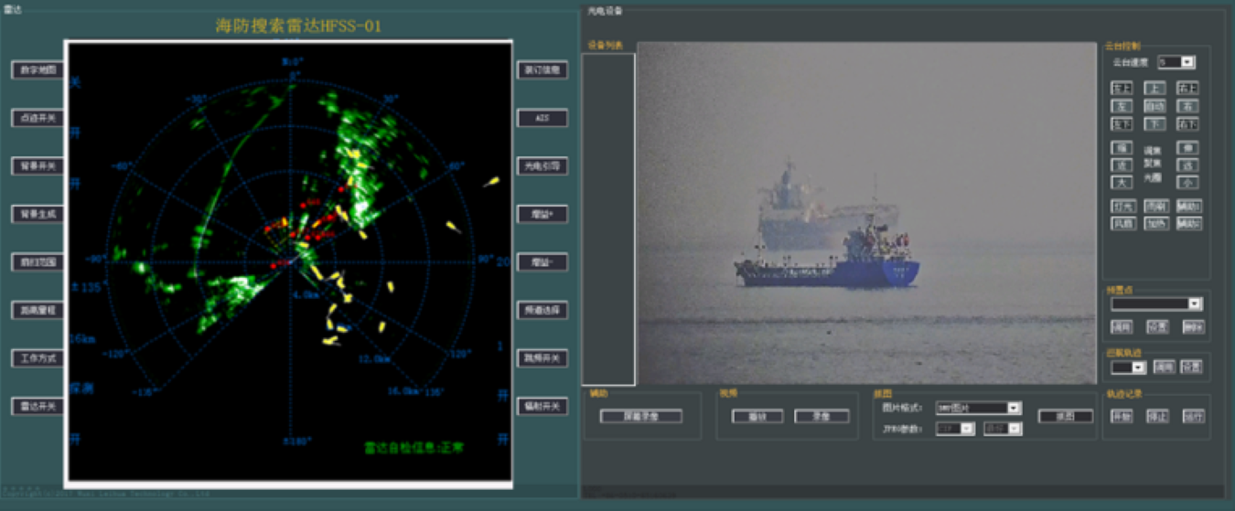
The system is capable of high-precision detection, tracking, and identification of sea areas in all-weather and OurHours sections, without being limited by weather and lighting conditions, ensuring continuous monitoring of maritime targets. Through the linkage of radar and optoelectronic equipment, the system can timely detect and lock suspicious targets, providing strong support for subsequent disposal measures.
The system supports setting up multi-layer prevention and control areas, and fine-grained warnings are made according to the danger level of the target. By setting up warning areas of different levels, the system can more effectively allocate resources and focus on monitoring and disposal of high-risk targets.
The system has powerful automatic classification and recognition capabilities. By fusing multi-source information such as radar, optoelectronics, and AIS, it accurately classifies and identifies maritime targets. This function not only improves the accuracy and efficiency of target recognition, but also provides a strong basis for subsequent decision-making and command.
The system has built-in image enhancement function, which can maintain high imaging monitoring capability under severe weather conditions. By adopting advanced image processing technology, the system can penetrate adverse weather factors such as haze, ensuring clear observation of maritime targets.
The system is equipped with strong light warning equipment, which can provide strong light warning and linkage driving away for illegal ships. This function can not only effectively curb the occurrence of illegal activities, but also reduce law enforcement costs and risks to a certain extent.
The system supports seamless monitoring of coastlines and nearby islands, achieving comprehensive coverage and seamless connection of the monitoring area. Through the collaborative work of multiple stations, the system can form a powerful monitoring network to ensure comprehensive control of the sea area.
The backend platform supports secondary development and can be customized according to user requests. At the same time, the platform also supports information exchange and linkage with other command systems to achieve data sharing and resource integration.
The system has self-check function and real-time monitoring function of equipment status during operation, which can timely detect and report equipment failures. This function not only improves the stability and reliability of the system, but also reduces the difficulty and cost of maintenance and repair.